The big highlight of today is our tour to Panmunjom and the Demilitarized Zone.
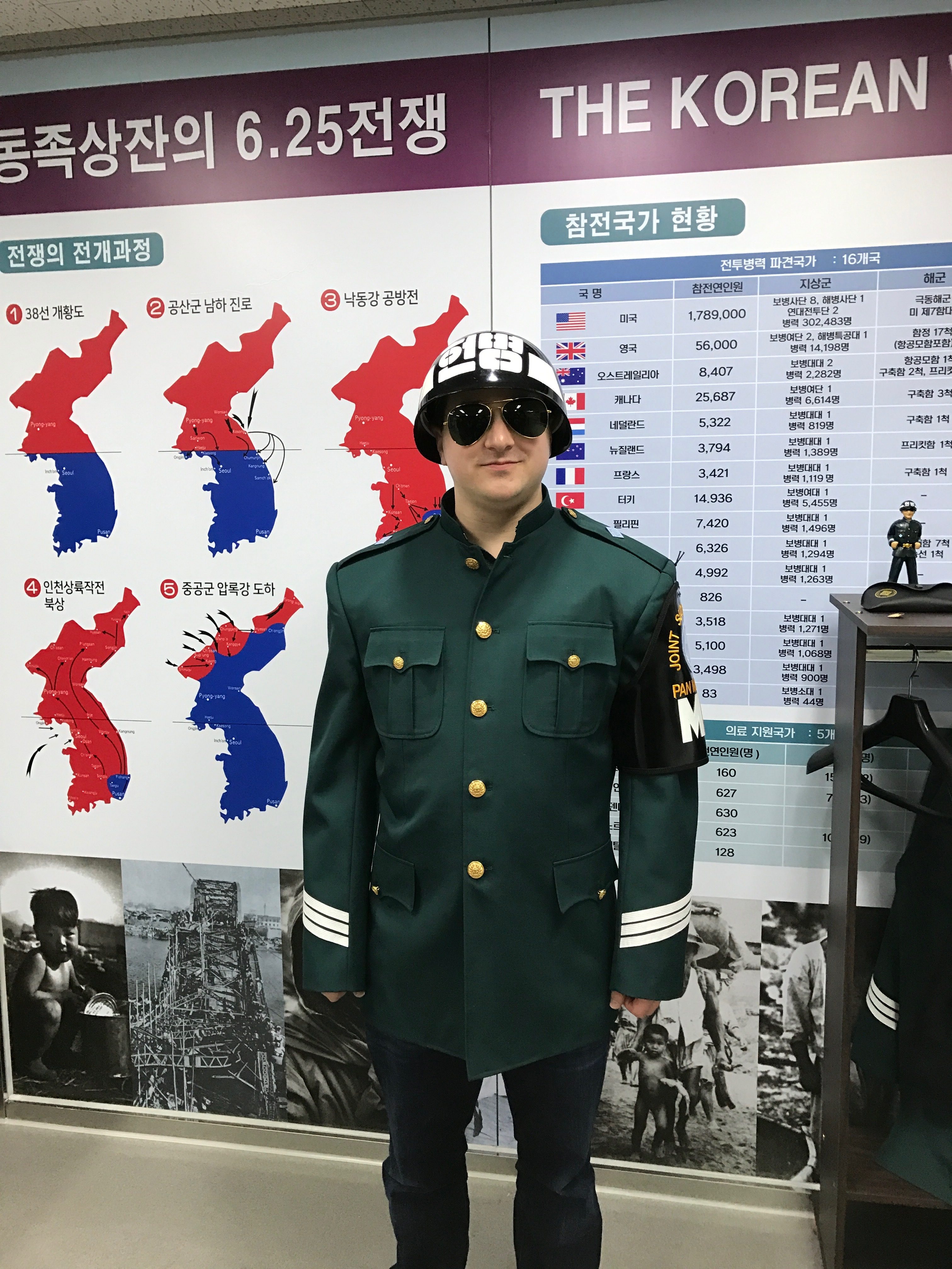
We woke up at 6:00 AM after about 8 hours of sleep (we had finally gone to bed around 0:00 PM the night before) and got ready to head out by 7:30. We went back to the subway station and caught Seoul Subway Line 2 to City Hall Station and then walked to the nearby Koreana Hotel from which our tour departed. When we checked in, we got to try on some of the uniform elements of the ROK Army guards which made for a pretty goofy picture.
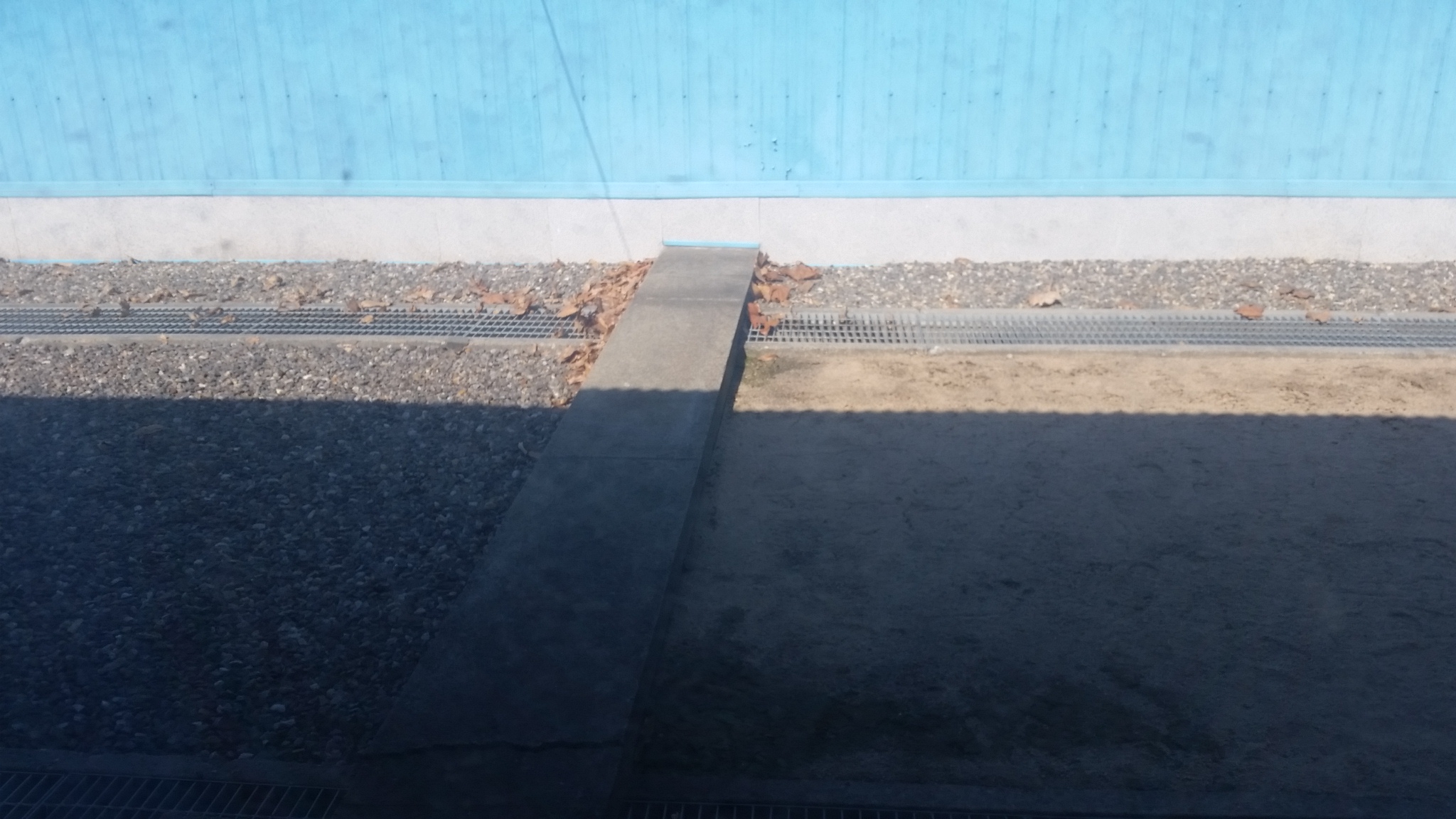
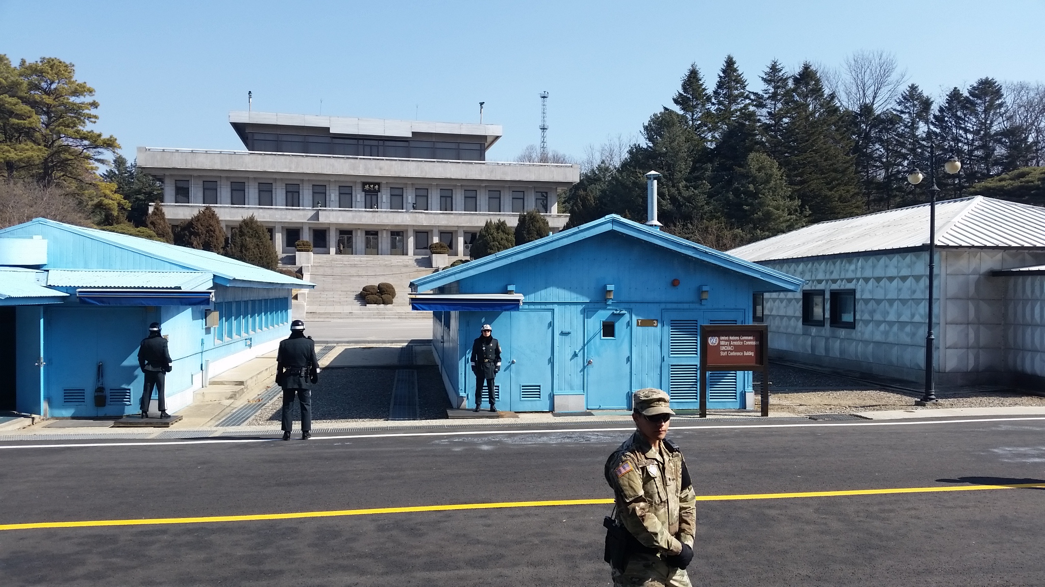
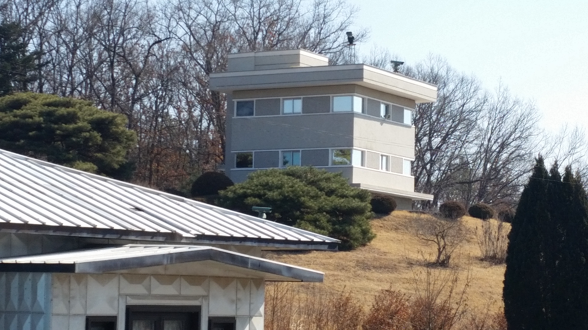
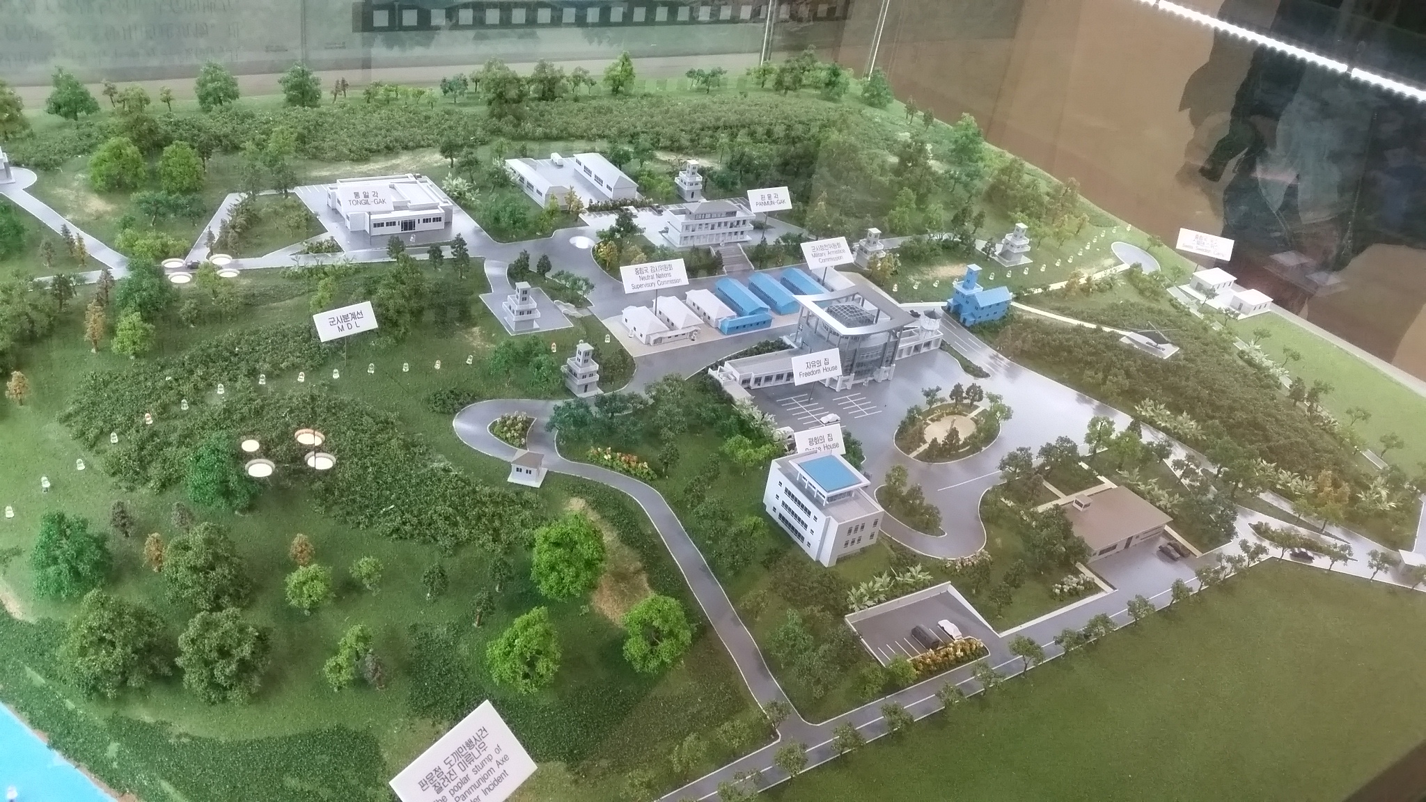
We took a bus for about an hour to reach our first checkpoint and enter the Civilian Control Area (CCA) that lies immediately south of the south side of the DMZ. At the checkpoint, a soldier boarded the bus to check everyone’s passports. We then drove to the second checkpoint, at the entrance to Camp Bonifas, where our passports were checked a second time and all the names were checked against a passenger manifest. They gave us clip-on badges to identify us as guests of the United Nations and we went inside for a briefing on the history of the DMZ and what to expect on the tour. We then drove to the Freedom House (main building on the South side of the border) inside Panmunjom (truce village/Joint Security Area) and walked into conference building T-2. This allowed us to cross into North Korean territory while still being safely inside a UN-controlled building; all the blue buildings are controlled by the UN Command, while the gray buildings are controlled by the Korean People’s Army (North Korea)/Chinese People’s Volunteers (China). Bisecting the buildings directly on the border is the Military Demarcation Line (MDL) which marks the official border between the two countries as set forth in the armistice agreement. Inside building T-2, a conference table is in the middle and the microphones in the middle of the table mark the MDL; outside the buildings, a concrete slab marks the MDL. Unfortunately, pictures inside the CCA, DMZ, and Panmunjom are extremely limited; most places have prohibited photography and the only pictures we were permitted to take were very constrained in terms of angles. The only places we could take pictures inside Panmunjom were directly at the border and angled toward North Korea, so I have no pictures of the Freedom House, the UNC observation posts, or any of the military fortifications (physical barricades and barriers) that exist in all of these areas. (I surmise that this is to reduce the amount of information that can be leaked unintentionally; details about physical fortifications can give insight into how to overcome them and details about the number/type of cameras or number/size/arrangement of antennas can expose observational capability.)
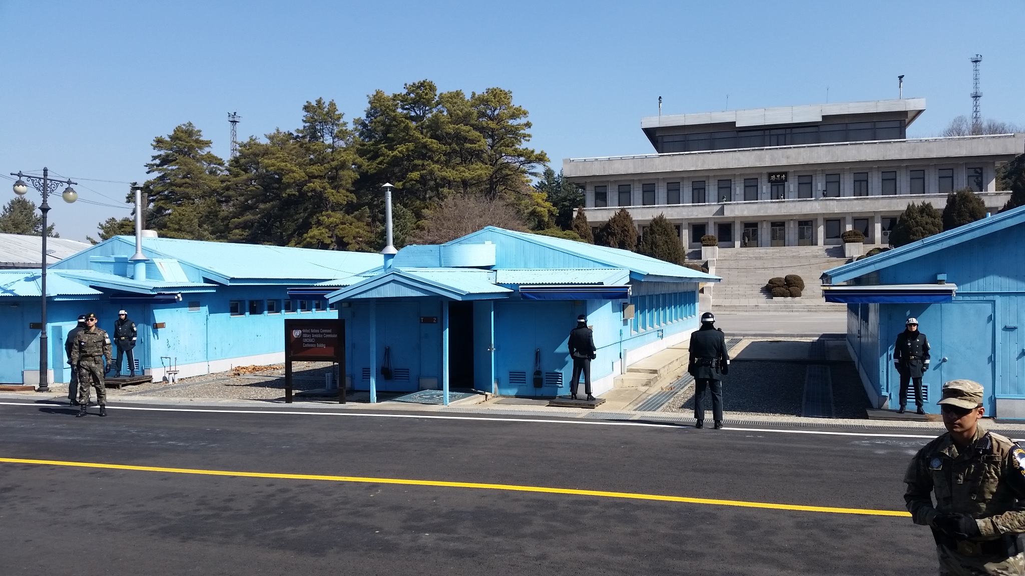
Soldiers from both sides patrol Panmunjom, but I only saw two North Korean soldiers out today. According to the US Infantryman who was guarding us, the North Korean soldiers really only come face-to-face with the ROK/UNC soldiers during high-level meetings or other VIP-type scenarios. However, he assured us that they were watching us from their main building and their nearby observation post.
After spending only a few minutes at Panmunjom, we departed and went back to the visitor center in Camp Bonifas so we could visit the gift shop and head toward Imjingak park to look at monuments to the war.

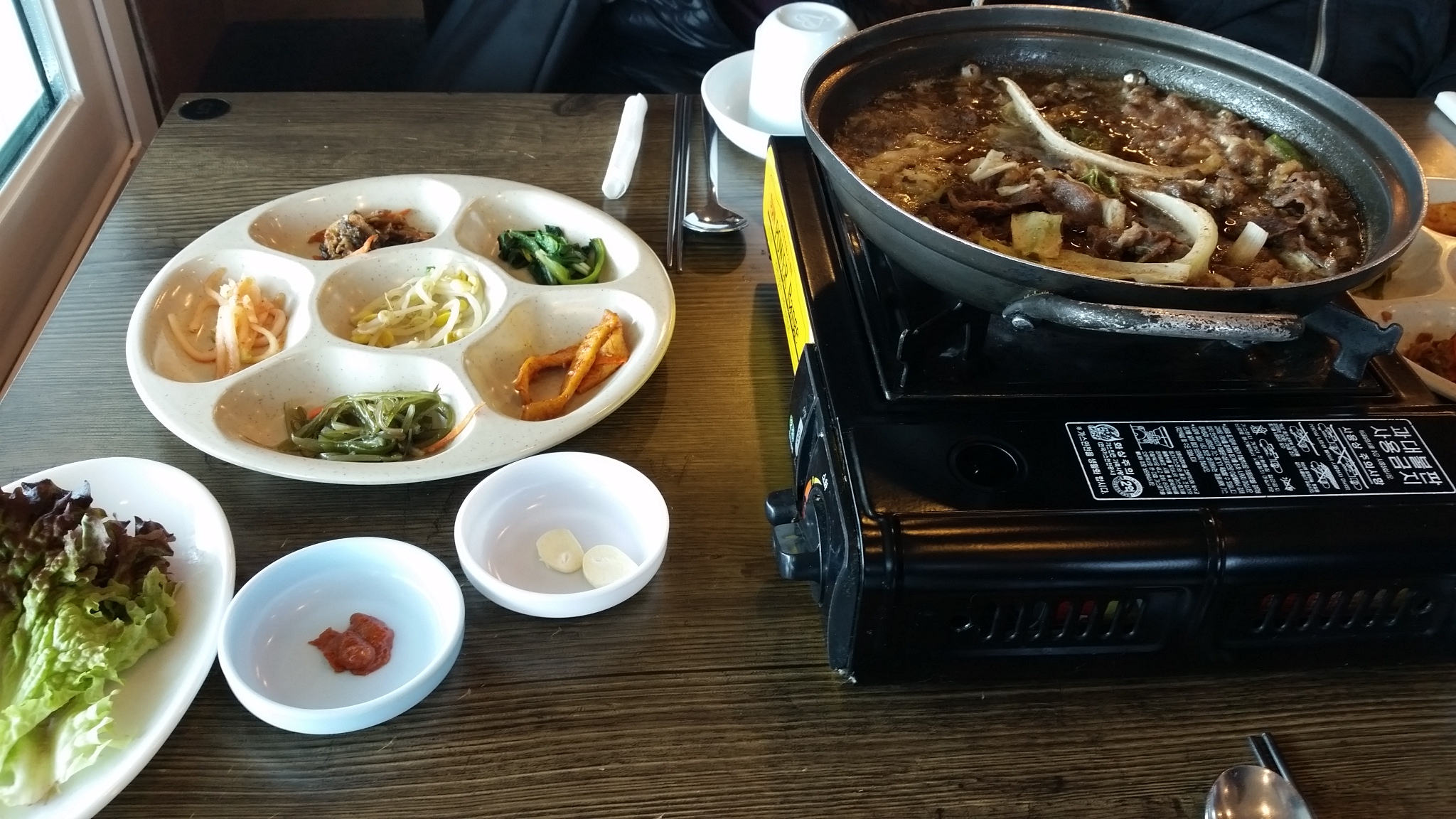
We then left for lunch at a local restaurant. They served beef bulgogi, and it was decidedly not the best bulgogi that I’ve had. Neither Grace nor I finished it.
Following lunch, we left to visit a tunnel dug by North Korea into the DMZ. This was, again, another area where photography was unfortunately restricted. However, our tour guide was careful to point out all the evidence* of the tunnel being dug by North Korea instead of South Korea; apparently this is a topic of contention between the two countries. We took a mine train (with seats that look to have been ripped out of the rear of a car) deep under a mountain through an extremely narrow tunnel; people needed to crouch and hunch over to avoid heads and shoulders hitting the rock. At the bottom, we walked through the tunnel as discovered by South Korea a few hundred meters to a concrete barrier that was constructed to block the tunnel. I think we were all thankful for the hardhats we wore; Grace and I both hit our heads a few times on the low ceiling. We then rode back up and visited a museum showing more about the tunnel and the DMZ in general
(* I do not feel qualified to judge whether or not the supplied evidence does indicate the provided conclusion. Prior to taking this tour, I did not doubt that the tunnels were dug by North Korea, however the insistence on the three particular pieces of evidence seemed odd to me.)
Our next stop of the tour was the top of the mountain at Dora Observatory. From here, we could see both Tae sung dong village (South Korean village inside the DMZ) and a North Korean propaganda village. We could see both gigantic flagpoles (South Korea’s is 100m tall, North Korea’s is 160m tall) and hear the propaganda being broadcast via loudspeaker from North Korean territory.
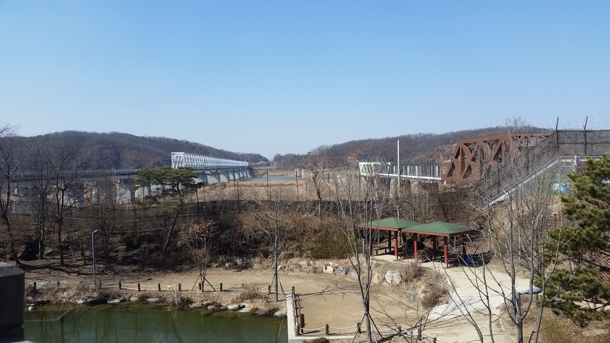
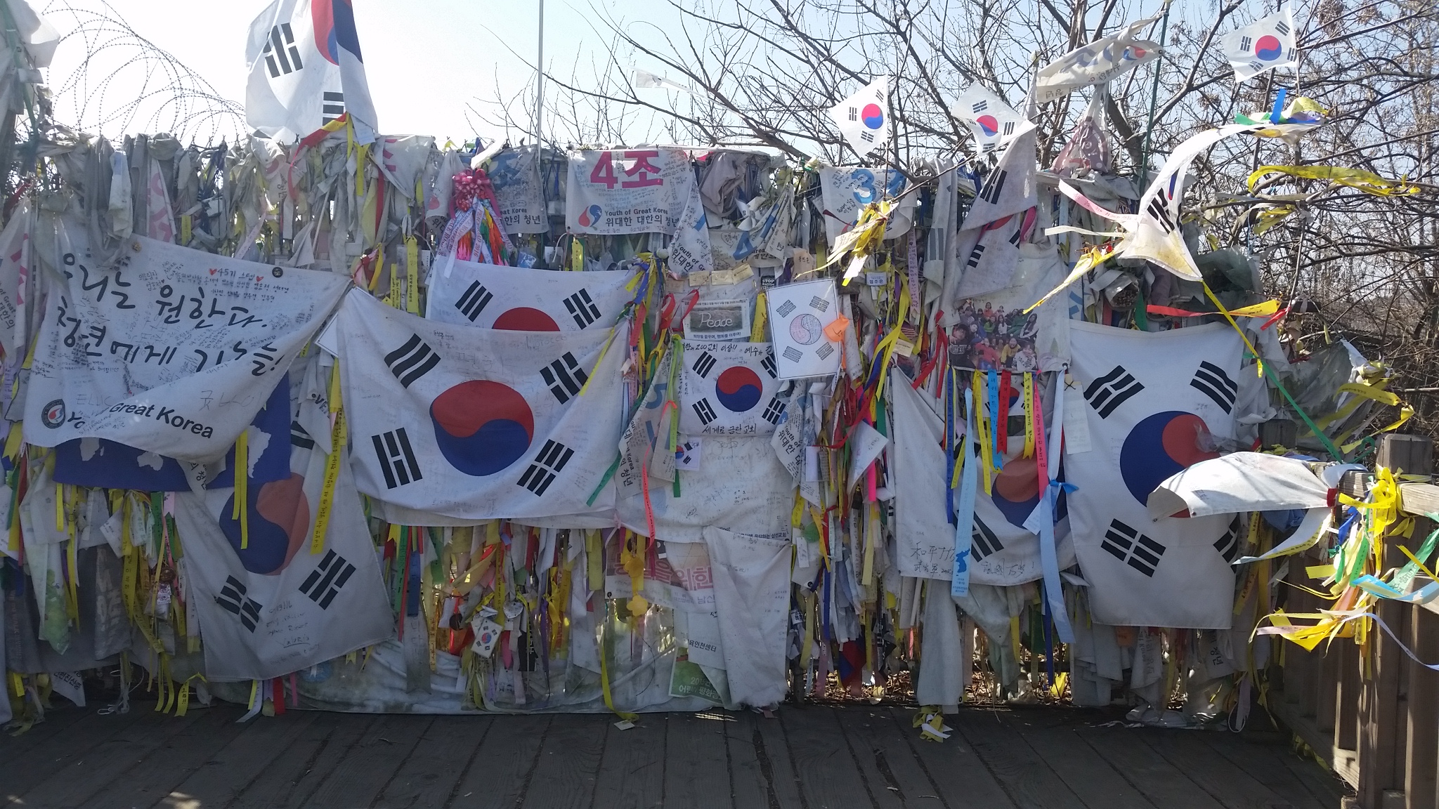
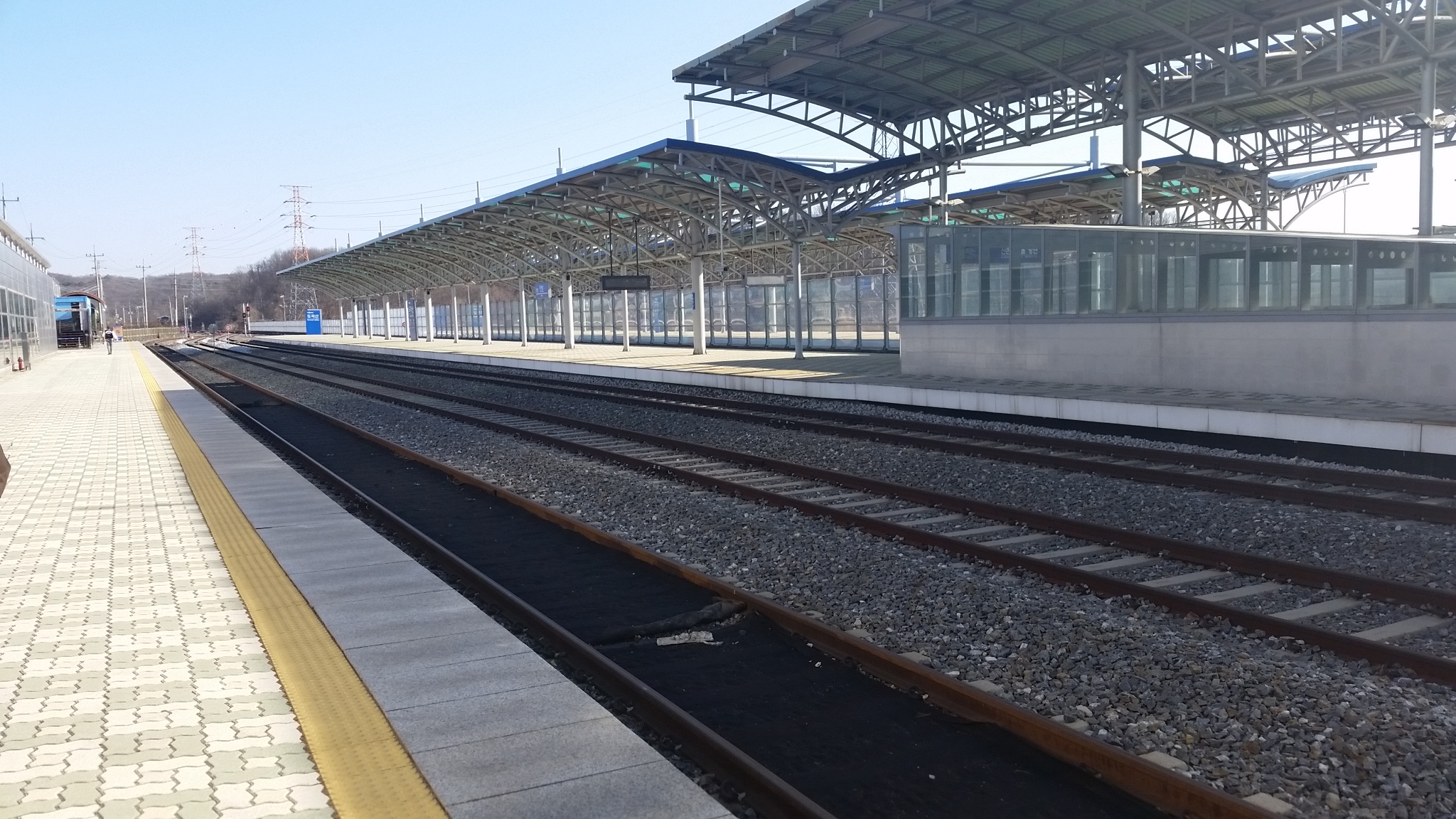
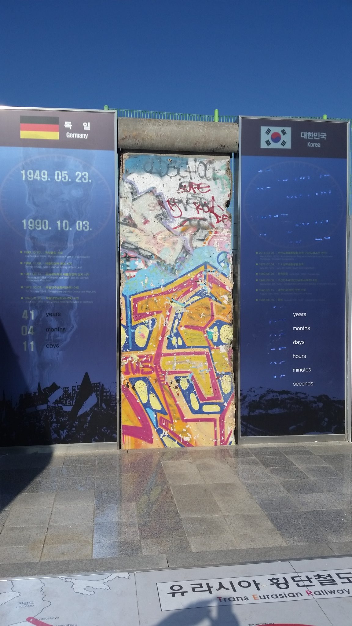
Our final stop on the tour before heading home was Dorasan Station, a train station within the CCA that serves as the last station before North Korea. Trains used to run to the Kaesong Industrial Region prior to increased tension between the countries; now it’s just the terminus of trains in South Korea. A piece of the Berlin Wall was donated to Dorasan Station and stands as a monument to strife created by building walls between people; the Berlin Wall stood for 41 years and the separation between two Koreas has endured for 71 years so far.
On our way back to Seoul, we got to ask questions of a North Korean defector who had been on the tour with us. She told us of her escape and her struggle, and of her family that is still in North Korea without any means of contact. It’s really crazy to hear what a different world it is inside the hermit kingdom.
One of the overarching themes of the day was reunification. I didn’t realize before coming here (and especially before taking this tour) how much some people really hope for the end of the North Korean regime and for civilians to be reabsorbed into society. The extent to which families have been divided by this conflict is pretty immense. However, my opinion on this hasn’t really changed; I don’t see a path to reunification while the Kim regime stands and I believe it’s going to be an extremely long and difficult process if it ever does come to pass.
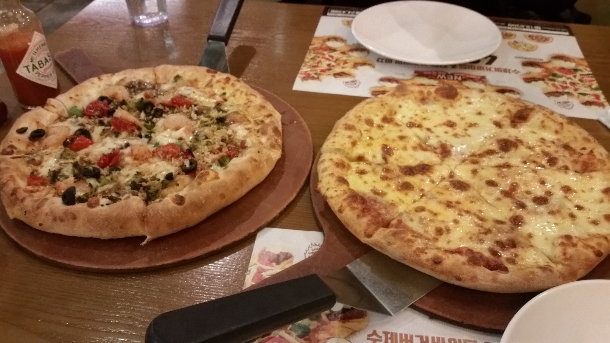
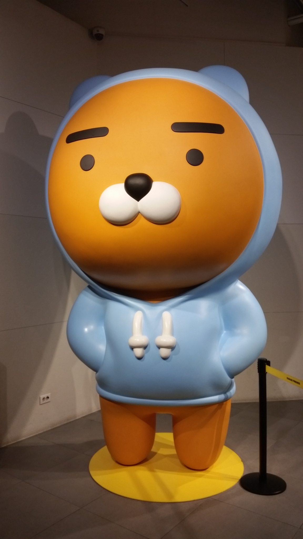
Grace and I went back to our AirBnB to rest after a long day. By the time we started feeling better, it was already getting late for dinner. We debated where to go and settled on trying to go somewhere close. Looking online, we thought that a Mr. Pizza (South Korean pizza chain) was nearby, but we couldn’t find it when we walked to the address we found. We then found another address, and it wasn’t there either. We ended up at Pizza Hut, which was a much nicer sit-down restaurant than I’ve seen in the US, though the food was fairly similar to pizza in the US. Along the way, we discovered a Kakao Friends store that Grace wanted to visit, so we went there on the way back.
Today, we discovered that Google Maps works really poorly in Seoul; according to an old friend who now lives here, this is because the South Korean government restricts the information that can be seen to try and reduce the risk of attack on the city. I’m hoping that we have better luck with it tomorrow; it’s really inconvenient as a tourist to not be able to have good directions on your phone.